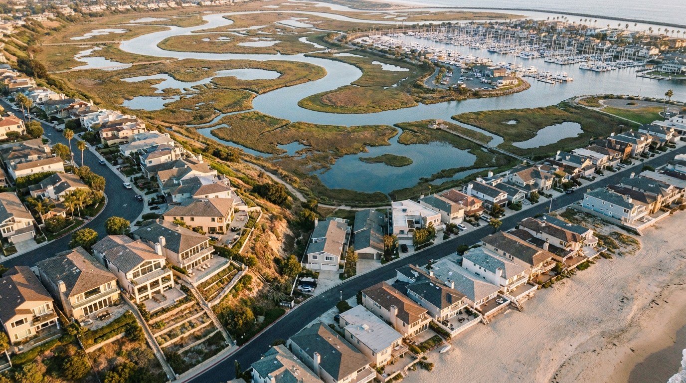
Playa Del Rey is compact, but it’s not uniform, and understanding its sub-areas and what borders it matters more here than in a lot of neighborhoods, mostly because of what sits on the other side of those borders.
The Broad Boundaries
Playa Del Rey sits along the coast, bordered by Marina Del Rey to the south, the Ballona Wetlands Ecological Reserve to the north and east, and LAX a short distance further inland to the east. That combination, marina, protected wetland, and airport, is fairly unique for a Westside neighborhood and shapes a lot of how the area actually lives day to day. For exact boundary lines on a specific address, it’s worth checking a current map rather than relying on general descriptions, since informal boundaries can vary depending on who you ask.
The Flats: Beach-Level Living
The flats are the lower-elevation section of Playa Del Rey, sitting close to the beach and the neighborhood’s main commercial strip along Culver Boulevard. Homes here tend to be a short walk from the sand, and the area has the more classic beach town feel that draws a lot of buyers to Playa Del Rey in the first place. It also puts residents closer to the LAX flight path noise that’s a real factor for some streets.
The Hill Section: Views and Separation
Above the flats, Playa Del Rey’s hill section climbs toward the bluffs, offering views that can include the ocean, the wetlands, or both depending on the exact street. This area tends to feel more residential and separated from the beach-level crowds, and homes here often command a premium for the view and the quieter setting. Our housing stock and architectural styles guide goes into more detail on what you’ll actually find built in each section.
Bordering Marina Del Rey
Playa Del Rey sits directly against Marina Del Rey, and the line between the two isn’t always obvious on the ground, especially near the harbor. Marina Del Rey is denser and more built up, with more high-rise condo buildings and a larger marina-focused commercial base, while Playa Del Rey stays smaller in scale. Buyers who want easy access to the Marina’s restaurants and boating without living in the middle of that density often specifically target Playa Del Rey’s side of the border.
The Ballona Wetlands Edge
The Ballona Wetlands Ecological Reserve forms a real, protected boundary on part of Playa Del Rey, and it’s not just open land, it’s an actively managed habitat. Streets closest to this edge back directly onto undeveloped, protected space, which is unusual for coastal LA and a genuine draw for buyers who want that kind of proximity to nature without leaving the city. Development along this border is more restricted than in a typical neighborhood, which also means it’s likely to stay that way long-term.
LAX’s Proximity and Why It Matters for Boundaries
Because LAX sits close to Playa Del Rey’s eastern edge, flight path exposure varies meaningfully across the neighborhood’s sub-areas, generally more noticeable in the flats and less so in parts of the hill section, though this isn’t a hard rule and depends on active runway patterns. If airport noise is a real concern for your search, it’s worth treating it as its own boundary consideration separate from the flats-versus-hill question.
Culver Boulevard as the Neighborhood’s Spine
Culver Boulevard runs through Playa Del Rey and functions as something close to the neighborhood’s main street, connecting the flats to the commercial strip and continuing out toward the wetlands border. It’s a useful reference point when orienting yourself on a map, streets closer to Culver tend to be more central to daily errands, while streets further from it, especially climbing into the hill section, trade that convenience for more quiet and separation.
Informal Sub-Area Names Buyers May Encounter
Beyond the flats and hill section distinction, buyers researching Playa Del Rey sometimes come across more informal, colloquial names for specific pockets used by longtime residents or older listings. These aren’t official designations and can mean slightly different things depending on who’s using them, so it’s worth confirming what a specific term actually refers to for any listing rather than assuming a shared definition across sources.
Getting Oriented for Your Own Search
Understanding Playa Del Rey’s sub-areas, the flats, the hill section, and how the neighborhood sits between the Marina, the wetlands, and LAX, makes it a lot easier to target the specific pocket that fits what you want. Efrat serves buyers and sellers across Los Angeles, including Playa Del Rey, and can help you map current inventory against these sub-areas for your specific search. Reach out to get oriented.
